The Last Leg Home
April 10-23-2025
A. Gilligan's Island Resort-04/10 to 04/12
I'd call this more of a mobile home/trailer park. It's location along White Lake with pool and lake access qualifies it as a "resort" but most of the RVs have screened in porches and decks that make them permanent year round homes. These RVs aren't going anywhere. On my road (there are only two in a U shaped configuration), I counted only four sites like mine with concrete pads and full hook-ups.
A 180º view.
White Lake, North Carolina, is a resort town in Bladen County, renowned for its crystal-clear waters and family-friendly atmosphere. White Lake is celebrated as one of the clearest lakes in North Carolina. Its waters are naturally filtered by artesian springs and feature a white sandy bottom, giving it a beach-like appearance. With an average depth of seven feet, twelve at its deepest, the lake's gentle slope and absence of tides or currents make it exceptionally safe for swimmers, especially families with children .
B. Pocahontas State Park - 04/12 to 04/15
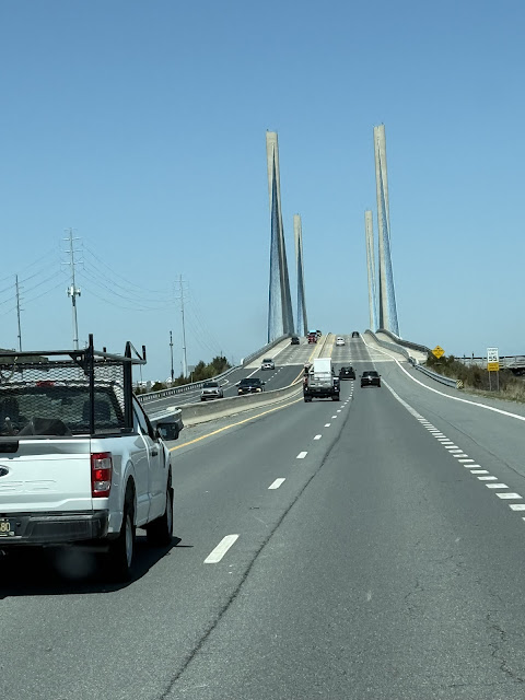
Today's 4-hour drive was surprisingly easy. The route was straight-forward and traffic was light. Southbound I-95 was a different story. That traffic was heavy. It's Saturday which may explain it. A cloudy day with temps in the low 50's, it was nice to see buds starting on trees, white and pink dogwoods and azalais in bloom.
 |
| Pocahontas State Park is one of 42 parks in the Virginia park system. It boasts thousands of campsites, hundreds of cabins, and more than 500 miles of trails and convenient access to Virginia's major waterways. |
Pocahontas State Park in Chesterfield, Virginia, derives its name from a 1940s naming contest held among local high schools. Nancy Roberts, a senior at Thomas Dale High School, won the contest by suggesting the name "Pocahontas Memorial State Park," in honor of Pocahontas, the daughter of Chief Powhatan of the Algonquin Nation. The "Memorial" part was later dropped, resulting in the current name, Pocahontas State Park.
 |
| Site 14 with 30amp service and water has picnic table and fire/cooking ring but no sewer. Surrounding tall pines and oak provided a familiar secluded, wooded environment with little or no amenities; one of the reason which makes me favor State Parks over commercial/family owned campgrounds. |

 |
| An Eastern Bluebird |
With the exception of the morning traffic of RVs exiting to be replaced by afternoon entering RV traffic, my last day at Pocahontas State Park was the best. Temps reached into the mid 70's and amidst the muted sunshine of late afternoon, the surrounding forest stirred with quiet life. Gentle breezes moved through the trees, coaxing shimmering leaves into a soft, rustling dance. Most incoming campers were settled so the air held a hush, broken only by the occasional call of a cardinal, its song weaving delicately through the stillness. A lone butterfly traced lazy circles in the warm light, drifting without urgency. The silence of the woodland wasn’t empty—it was full of presence, a peaceful pause in time that explains to a tee, my love for this life of travel and relaxation; where even the shadows seemed to breathe. Everything responded, subtly, to the breeze—as if the forest itself were exhaling. Peaceful and serene.Shimmering leaves.
This Eastern Bluebird was fixated with its reflected image on a camper’s car window most of the afternoon.C. First Landing State Park-04/15 to 04/17
 |
| The most visited state park in Virginia. |
In a drive that took me in a southeasterly direction toward the Ocean, through the Hampton Roads Bridge Tunnel and to the mouth of Chesapeake Bay, First Landing State Park is another Virginia State Park I'll be spending a couple of nights. This park is where English colonists first landed in 1607. Native American canoes, Colonial settlers, 20th-century schooners and modern cargo ships have navigated the park's waterways. Its cypress swamps were a source of fresh water for merchant mariners, pirates and military ships during the War of 1812. Legend has it that Blackbeard hid in the Narrows area of the park, and interior waterways were used by Union and Confederate patrols during the Civil War. Built in part by an all African-American Civilian Conservation Corps in 1933-1940, the park is a National Natural Landmark and is listed in the National Register of Historic Places.
The park is huge. Lots of tent sites, cabins and yurts. There's water and electric (30/50amps) hook-up at RV campsites (no sewer), picnic areas, boat ramps and a camp store. They make a note of the fact that the park is located just south of the military training center that operates year-round in any weather at any time of day or night. JEBLS-FS (Joint Expeditionary Base Little Creek–Fort Story) combines two former separate installations:
The base supports Navy amphibious operations, including training for special warfare and expeditionary forces. At 5:00 pm, my first day here, I heard the bugle call for "Retreat," which signals the end of the workday. You can hear it HERE.
 |
| Yup, as far from entrance as you can go. Site 141. Thickly wooded, secluded and cozy...just the way I like it. |
.JPEG) |
| On the way to my campsite, I passed spacious areas for tenting and picnicking. Common to this area are either Live Oak or Southern Red Oak, whose twisting, sprawling branches often grow horizontally or even dip toward the ground. |
.JPEG) |
| A well established forest lined the half mile drive to site 141. |
.JPEG) |
| My 2-night stay on well-protected site 141 was totally relaxing. |
.JPEG) |
| Unused picnic table and fire ring adapted for grilling are found on sites. |
.JPEG) |
| I ventured along a trail into the wooded area behind my site. |
.JPEG) |
| Nothing but Nature at its best. |
.JPEG) |
| In the distance, the next campsite and the Wingfield Bath House. |
And the usual 180º from the road:
D. Delaware Seashore State Park-04/17 to 04/21
Today's drive was a scenic route along the coast, SR-60 to SR-13, the famous Chesapeake Bay Bridge/Tunnel and finally Route 1 to Bethany Beach, MD. As many times as I've driven this 17.6 mile roadway, I continue to be in awe of the magnitude of one of the most impressive engineering feats in the United States—a combination of bridges and tunnels spanning the mouth of the Chesapeake Bay in Virginia.
.JPEG) |
| After paying a $23.00 toll for my motorhome and pulling off to the side of the roadway to shut off my propane tank, I was on my way. |
.JPEG) |
| Opening in April, 1964, the system connects Virginia Beach with Cape Charles. |
.JPEG) |
| There are two tunnels, four high-level bridges, 12 miles of low-level trestles and 2 man-made islands for the tunnel portals. |
I chuckled as I thought of my of gephyrophobic (fear of bridges) and tunnel phobic friends. This was not the ride they would enjoy. I know it's a thing. Some people hire drivers or use escort services to cross due to anxiety.
.JPEG) |
| The first tunnel, The Thimble Shoal Channel Tunnel takes you down 103 feet beneath the Bay, |
.JPEG) |
| Maintaining a speed of 55 m.p.h. you cannot but help thinking, "What if..." |
.JPEG) |
| But before you know it, you've hit the lowest part and are headed "uphill." There, "the light at the end of the (1.05 mile) tunnel" awaits. |
.JPEG) |
| The second tunnel, the Chesapeake Bay Tunnel, is also about 1.03 miles and drops to a depth of 105 feet. The arrows above are pointing to the tunnel portals atop the man-made islands. |
.JPEG) |
| As I approached the tunnel, what I thought was a land form and buildings turned out to be an ocean-bound cargo ship. What are the chances that we both meet at the tunnel? |
.JPEG) |
| Another photo I took with labels to add to the excitement of who will win the race to the tunnel portal. |
.JPEG) |
| Drum roll, please. |
 |
| I'm calling it a tie. What are the chances? |
I researched the ACL cargo ship and found the ACL (Atlantic Container Line) cargo vessels are a series of innovative Conro (Container/Roll-on Roll-off) ships--a hybrid between container ships and roll-on/roll-off (Ro-Ro) vessels. Their primary use is for transporting containers, vehicles, heavy machinery and project cargo. This ship, one of five in its class is about 970 feet long, 123 feet at its beam and its deadweight tonnage (DWT) is approximately 55,000 tons.
.JPEG) |
| Cape Charles off in the distance. |
.JPEG) |
Now on US-1 and having driven through 15 miles of Ocean City, the tourist trap of Maryland, I approached my destination via the Charles W. Cullen Memorial Bridge.
|
 |
| Notice there are TWO campgrounds that line the Indian River. My reservation printout did not specify which one I was assigned. After touring the South Campground, it became apparent that I belonged in the North campground. Add a half hour travel time. |
 |
| With some tricky turns and quick decisions, I found my way. |
 |
| My site, #424 is full hook-up with 30/50 amps, water and sewer. |
.JPEG) |
| Not a tree in sight. This is actually a good thing because temps upon arrival were in the mid 50's and breezy. The night time temps will be in the mid 40's. I guess this goes along with becoming acclimated to the northeast once again. |
.JPEG) |
| As the afternoon wore on, most of the sites were filled with every description of motor home. |
.JPEG) |
| Adjacent site filled by 4:00 p.m. |
.JPEG) |
| The Charles W. Cullen Memorial Bridge is also known as the Indian River Inlet Bridge. It's named for a distinguished Delaware lawyer and judge who served on the State Highway Commission from 1930 to 1940, including a term as chairman. |
 |
| My first sunset (7:29 pm) on 4/17th. Subsequent sunsets were non-descript as the haze blocked its view each evening. |
 |
“Over all, encircling all, to my sight and soul, and free space of the sky, transparent and blue—and hovering there in the west, a mass of white-gray fleecy clouds the sailors call ‘shoals of mackerel’—the sky, with silver swirls like locks of toss’d hair, spreading, expanding—a vast voiceless, formless simulacrum—yet may-be the most real reality and formulator of everything—who knows?” ~~ Walt Whitman ‘Specimen Days, A July Afternoon by the Pond’ in Prose Works (1892). |
Hope you had a wonderful Easter Sunday.
Lewes to Cape May Ferry - 04/21
Easter Monday morning, I bid adieu to cloudy, breezy Delaware Seashore State Parks and its barking/yelping/yapping dogs.
The experience of the 85 minute, 17 mile ferry ride either way aboard the Cape May/Lewes Ferry is one I would recommend. View a 3-minute video HERE to see what it has to offer the traveler.
In addition to the scenic views and relaxing atmosphere, it saves about 100 miles of driving between New Jersey and Delaware thus avoiding the Philadelphia or Baltimore traffic. My destination, the Belleplain State Forest is just 25 miles or about a half hour ride further north.
 |
Two ferries in operation today. I was aboard the M/V (Motor Vessel) Delaware, the other, the M/V Jersey, the alternate ferry. At 320 feet in length, the Delaware, named after the first state, can hold up to 100 vehicles and 800 passengers. It's a "double-ended" ferry which means it does not have to turn around when docking. The Ferry system operates 12 months a year, |
 |
| While waiting to board, I was gratified to see security in action. This officer and his mate walked up and down each side of vehicles in each row. |
 |
| When I first arrived and assigned to Lane 22, another security person scanned the bar code on my ticket stub and then told me to open my side door so that he could "peek in." A quick glance in and he was gone. |
It was an overcast day and with a "feel like" temperature of 41°, the voyage did not lend itself to sitting outside on the deck. Had a bite to eat inside, where most of the crowd hung out but spent the last twenty-five minutes inside the comfort of Winnie. Here's a view of my driving on board.
Belleplain State Forest - 04/21 to 04/23 |
I visited this State Park in November last year on my way south that began my Winter Adventure. To reminisce, you can re-read that blog HERE. I provide a more detailed description of that experience than I will here. Then, my site was 102, today it's 113.
 |
| Site 113. Spacious, easy in and out with water and 30/50 amp. service. No sewer hook up but the dump station and bathrooms are across the road. Here's a 360º view. |
Although I was here for only two days, what stood out most was the silence—the kind that settles over nature untouched, just one of the benefits of camping in State Parks. There were no amenities, no distractions—just people quietly enjoying the outdoors, spread far enough apart to feel alone. And then came the nights: no streetlights, no camper lights, only the wind whispering through the pines. It was another peaceful and beautiful experience I enjoy while camping—being surrounded by trees, listening to the breeze compose its woodland symphony.
My final destination awaits in Croton, "my other home away from home." Site 35 is 180 miles, 3½ hours away. I'll be there five days. Dear neighbor, Diane, will get me home so I can pick up my Caddy and begin transporting and preparing Winnie for its month's storage.
And so, this journey comes to a close, the end of my 2025 Winter Adventure. It’s hard to believe my time has come to an end...on Earth Day no less; five months away from home. Quiet moments, fresh air, space to breathe, and a kind of stillness that stays with you. I’ll remember the hush of the pines, the way the night wrapped around everything like a blanket, and how it felt to be completely off the grid.
As the saying goes, all good things must come to an end—but I’ve come to believe that endings are simply pauses before the next adventure begins. Until then, here’s to the silence, the stars, and the promise of more stories to come. Thanks for following along. Until the next chapter in the next blog.
“Every new beginning comes from some other beginning’s end.” Seneca

.jpg)


.jpg)


.jpg)


.JPEG)
.JPEG)
.JPEG)
.JPEG)
.JPEG)
.JPEG)
.JPEG)
.JPEG)
.JPEG)
.JPEG)
.png.jpg)
.JPEG)
.JPEG)
.JPEG)
.JPEG)
.JPEG)
.JPEG)
.JPEG)
.JPEG)
.JPEG)
.JPEG)
.JPEG)

.JPEG)
.JPEG)


.JPEG)
.JPEG)
.JPEG)
.JPEG)


.jpg)


.jpg)